File:Atlantic bathymetry.jpg
Ɓetol ngol jiytol: 480 × 600 piksel. weerngooji: goɗɗi 192 × 240 piksel | 384 × 480 piksel | 614 × 768 piksel | 819 × 1 024 piksel | 1 638 × 2 048 piksel | 4 000 × 5 000 piksel.
Fiilde asliire (4 000 × 5 000 piksele, ɓetol fiilde: 9,12 MB, mbaydi MIME: image/jpeg)
| Cifagol |
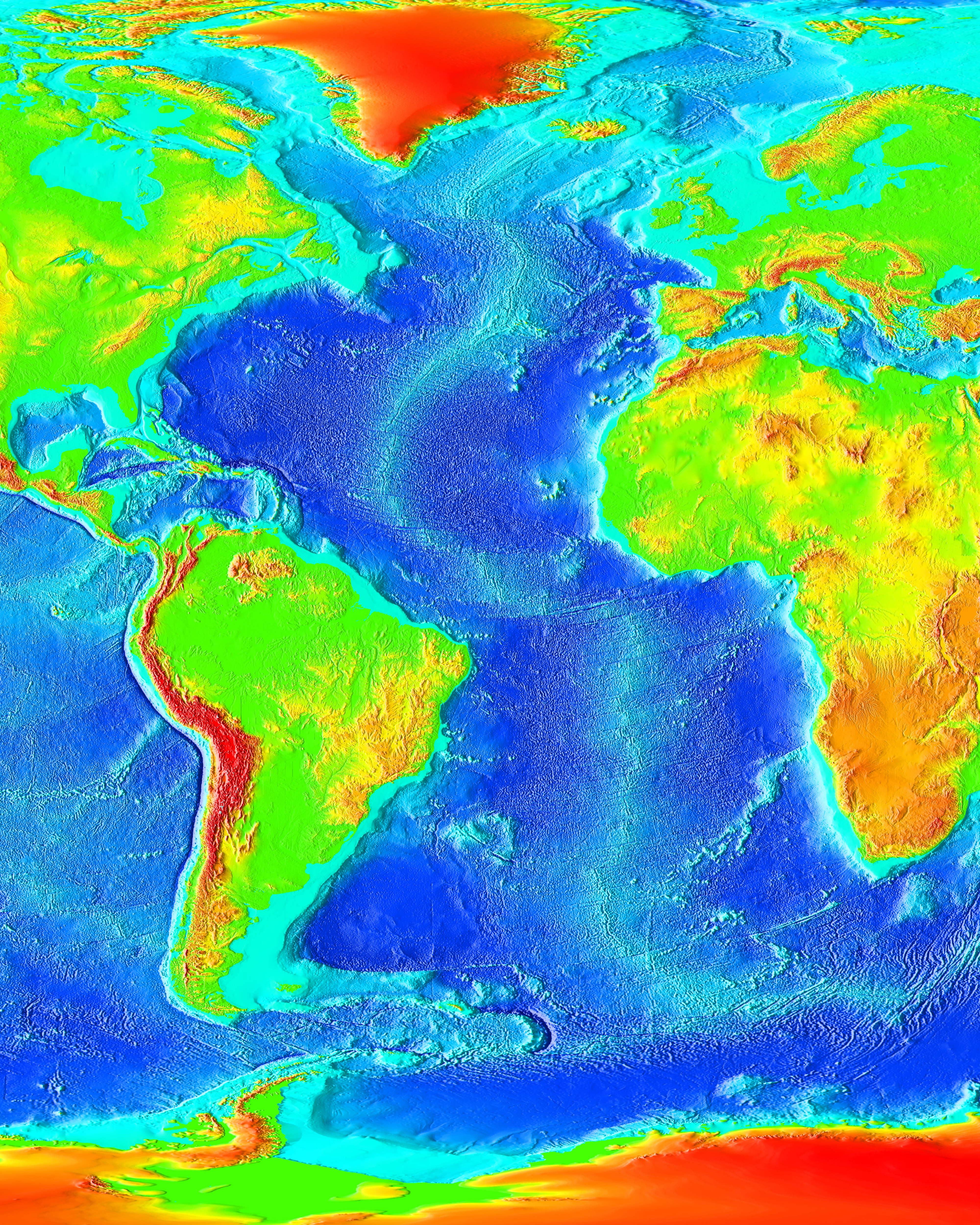
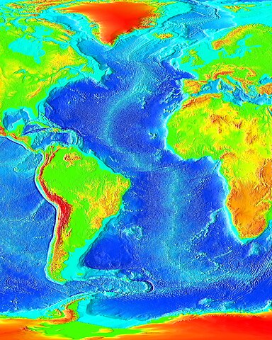
English: The Atlantic Ocean. |
| Sewnde | http://www.ngdc.noaa.gov/mgg/image/2minrelief.html |
| Binnduɗo | NOAA |
This image is in the public domain because it contains materials that originally came from the U.S. National Oceanic and Atmospheric Administration, taken or made as part of an employee's official duties.
|
Aslol fiilde
Dobo e ñalngu/waktu ngam yiyde fiilde ndee no nde yaltirta e oon waktu nih.
| Ñalngu/Waktu | Dooɓre | Ɓete | Kuutoro | Yowre | |
|---|---|---|---|---|---|
| gonaaɗo | 19:55, 19 Juko 2023 | | 4 000 × 5 000 (9,12 MB) | Kersti Nebelsiek | higher resolution |
| 19:20, 27 Jolal 2006 |  | 1 825 × 2 000 (450 KB) | Korrigan | Rétablissement de la version précédente | |
| 11:21, 14 Jolal 2006 |  | 547 × 599 (97 KB) | Ludo29 | The Atlantic Ocean. Source: http://www.ngdc.noaa.gov/mgg/image/2minrelief.html Récupéré depuis Wikipédia:en avec le même nom | |
| 02:08, 15 Mbooy 2006 |  | 1 825 × 2 000 (450 KB) | Interiot~commonswiki | change framing | |
| 02:03, 15 Mbooy 2006 |  | 1 491 × 2 000 (372 KB) | Interiot~commonswiki | == Summary == The Atlantic Ocean. Source: http://www.ngdc.noaa.gov/mgg/image/2minrelief.html == Licensing == {{PD-USGov}} Category:Ocean topography |
Kuutorgol fiilde
Alaa kelle kuutotooɗe ndee fiilde.
Kuutoragol fiilde kuuɓtidinngol
Wikiiji ɗii-ɗoo goɗɗi ena kuutoroo ndee fiilde:
- Kuutoragol e af.wikipedia.org
- Kuutoragol e ar.wikipedia.org
- Kuutoragol e ast.wikipedia.org
- Kuutoragol e az.wikipedia.org
- Kuutoragol e az.wiktionary.org
- Kuutoragol e bat-smg.wikipedia.org
- Kuutoragol e ba.wikipedia.org
- Kuutoragol e beta.wikiversity.org
- Kuutoragol e be.wikipedia.org
- Kuutoragol e bn.wikipedia.org
- Kuutoragol e ca.wikipedia.org
- Kuutoragol e co.wikipedia.org
- Kuutoragol e crh.wikipedia.org
- Kuutoragol e cy.wikipedia.org
- Kuutoragol e de.wikipedia.org
- Kuutoragol e de.wikinews.org
- Kuutoragol e de.wiktionary.org
- Kuutoragol e diq.wikipedia.org
- Kuutoragol e en.wikipedia.org
- Kuutoragol e en.wikibooks.org
- Kuutoragol e en.wikiversity.org
- Kuutoragol e eo.wikipedia.org
- Kuutoragol e es.wikipedia.org
- Kuutoragol e ext.wikipedia.org
- Kuutoragol e fi.wikipedia.org
- Kuutoragol e fo.wikipedia.org
- Kuutoragol e fr.wikipedia.org
- Kuutoragol e fr.wikiversity.org
- Kuutoragol e gd.wikipedia.org
- Kuutoragol e gl.wikipedia.org
Yiy jokkol kuutoragol kuuɓtidingol ngoo hello.