File:BRA orthographic.svg

Size of this PNG preview of this SVG file: 551 × 551 piksel. weerngooji: goɗɗi 240 × 240 piksel | 480 × 480 piksel | 768 × 768 piksel | 1 024 × 1 024 piksel | 2 048 × 2 048 piksel.
Fiilde asliire (Fiilde SVG, werngo mum ko 551 × 551 pikelle, ɓetol fiildee: 1,41 MB)
Tonngol
| Cifagol |
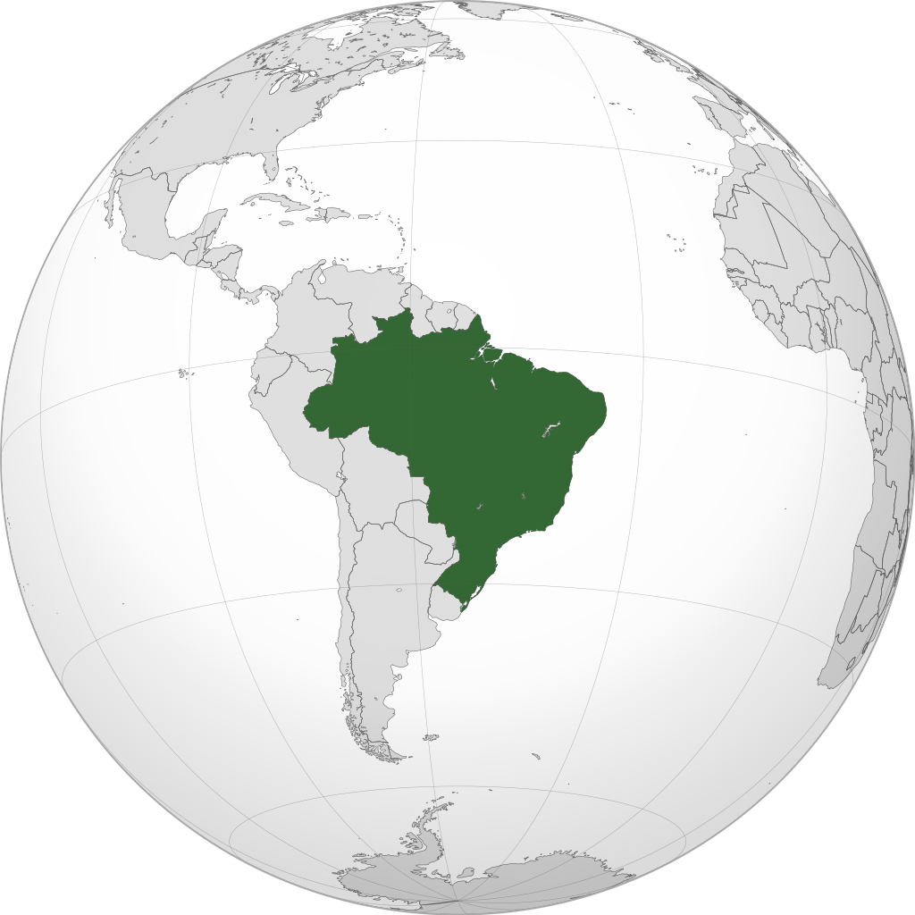
English: A map of the hemisphere centred on -54, -14, using an orthographic projection, created using gringer's Perl script with Natural Earth Data (1:50000 resolution, simplified to 0.25px). Brazil is highlighted in green. |
| Ñalngu | |
| Sewnde | Own work using: Natural Earth Data |
| Binnduɗo | Addicted04 |
| SVG genesis |
.svg)
.svg)
.svg)
.svg)
.svg)
.svg)
.svg)
.svg)
.svg)
.svg)
.svg)
.svg)
.svg)
.svg)
.svg)
.svg)
.svg)
.svg)
.svg)
.svg)
.svg)
.svg)
.svg)
.svg)
.svg)
.svg)
.svg)
.svg)
.svg)
.svg)
.svg)
.svg)
.svg)
.svg)
.svg)
.svg)
.svg)
.svg)
.svg)
.svg)
.svg)
.svg)
.svg)
.svg)
.svg)
.svg)
.svg)
.svg)
.svg)
.svg)
.svg)
.svg)
.svg)
.svg)
.svg)
.svg)
.svg)
.svg)
.svg)
.svg)
.svg)
.svg)
.svg)
.svg)
.svg)
.svg)
.svg)
.svg)
.svg)
.svg)
.svg)
.svg)
.svg)
.svg)

.svg)

.svg)

.svg)
.svg)
.svg)
.svg)
.svg)
.svg)
.svg)


.svg)
.svg)
.svg)
.svg)
.svg)
.svg)
.svg)

.svg)
.svg)
.svg)
.svg)
.svg)
.svg)
.svg)
.svg)
.svg)

.svg)
.svg)
.svg)
.svg)
.svg)
.svg)
.svg)
_without_national_boundaries.svg)
.svg)
.svg)
.svg)
.svg)
.svg)
.svg)

.svg)
.svg)
.png)
.svg)
.svg)
.svg)
.svg)

.svg)
.svg)
.svg)
.svg)
.svg)
.svg)
.svg)
.svg)
.svg)
.svg)
.svg)

.svg)
.svg)
.svg)
.svg)
.svg)
.svg)
.svg)
.svg)
.svg)

.svg)
.svg)

.svg)
.svg)
.svg)
.svg)
.svg)
.svg)
.svg)
.svg)
.svg)
.svg)
.svg)
.svg)
.svg)
.svg)
.svg)
.svg)
.svg)
.svg)
.svg)
.svg)
.svg)
.svg)
.svg)
.svg)
.svg)
.svg)
.svg)
_-_Crimea_disputed.svg)
.svg)
.svg)
.svg)
.svg)
.svg)
.svg)
.svg)
.svg)
.svg)
.svg)
.svg)
_political.svg)
.svg)
.svg)
.svg)
.svg)
_-_Crimea_disputed_-_no_borders.svg)
.svg)
.svg)
.svg)
.svg)
.svg)
.svg)
.svg)
.svg)
.svg)
.svg)
.svg)

.svg)
.svg)
.svg)

.png)
.svg)
.svg)
.svg)
.svg)
.svg)
.svg)
.svg)
.svg)
.svg)
.svg)
.svg)
.svg)
.svg)
.svg)
.svg)
.svg)
.svg)
.svg)
.svg)
.svg)
.svg)
.svg)
.svg)
.svg)
.svg)
.svg)
.svg)
.svg)
.svg)
.svg)
.svg)
.svg)
.svg)
.svg)
.png)
.svg)
.svg)
.svg)
_(orthographic_projection).png)
| Orthographic projections maps created by Ssolbergj |
|---|
| Orthographic projections maps created by Ssolbergj: |
.svg)
.svg)
Jamirooje
I, the copyright holder of this work, hereby publish it under the following license:
This file is licensed under the Creative Commons Attribution-Share Alike 3.0 Unported license.
- Aɗa wellitii:
- e lollinde – e tummbitaade, saakde e ɓenninde golle ɗee
- e muultaade – e jaaɓtinde
- E ɗii-ɗoo sarɗiiji:
- fe'inana – You must give appropriate credit, provide a link to the license, and indicate if changes were made. You may do so in any reasonable manner, but not in any way that suggests the licensor endorses you or your use.
- lollin nannduɗe – If you remix, transform, or build upon the material, you must distribute your contributions under the same or compatible license as the original.
Aslol fiilde
Dobo e ñalngu/waktu ngam yiyde fiilde ndee no nde yaltirta e oon waktu nih.
| Ñalngu/Waktu | Dooɓre | Ɓete | Kuutoro | Yowre | |
|---|---|---|---|---|---|
| gonaaɗo | 06:56, 6 Siilo 2015 | | 551 × 551 (1,41 MB) | Denniss | Reverted to version as of 15:23, 19 January 2014 |
| 00:50, 6 Siilo 2015 |  | 2 000 × 1 700 (765 KB) | Mondolkiri1 | Novo upload para corrigir o arquivo - Brasil no contexto da UNASUL | |
| 00:37, 6 Siilo 2015 |  | 744 × 1 052 (927 KB) | Mondolkiri1 | Brasil na UNASUL (Verde claro) | |
| 15:23, 19 Siilo 2014 |  | 551 × 551 (1,41 MB) | Addicted04 | New map | |
| 17:57, 14 Yarkomaa 2011 |  | 550 × 550 (847 KB) | Addicted04 | Circule border | |
| 22:36, 12 Yarkomaa 2011 |  | 550 × 550 (846 KB) | Addicted04 |
Kuutorgol fiilde
Ngoo hello ena huutoroo ndee fiilde:
Kuutoragol fiilde kuuɓtidinngol
Wikiiji ɗii-ɗoo goɗɗi ena kuutoroo ndee fiilde:
- Kuutoragol e ar.wikipedia.org
- البرازيل
- برتغالية برازيلية
- مستخدم:جار الله/قائمة صور مقالات العلاقات الثنائية
- العلاقات الأنغولية البرازيلية
- العلاقات البرازيلية الكورية الجنوبية
- العلاقات البرازيلية الإريترية
- العلاقات البرازيلية السويسرية
- العلاقات الألمانية البرازيلية
- العلاقات البرازيلية الليختنشتانية
- العلاقات البرازيلية البوليفية
- العلاقات البرازيلية الموزمبيقية
- العلاقات البرازيلية البلجيكية
- العلاقات البرازيلية الإثيوبية
- العلاقات البرازيلية البيلاروسية
- العلاقات البرازيلية الطاجيكستانية
- العلاقات البرازيلية الروسية
- العلاقات البرازيلية الرومانية
- العلاقات البرازيلية الغامبية
- العلاقات البرازيلية القبرصية
- العلاقات البرازيلية السيراليونية
- العلاقات البرازيلية النيبالية
- العلاقات البرازيلية الليبيرية
- العلاقات البرازيلية التشيكية
- العلاقات البرازيلية الميانمارية
- العلاقات البرازيلية الكندية
- العلاقات البرازيلية الزيمبابوية
- العلاقات البرازيلية البالاوية
- العلاقات البرازيلية المالية
- العلاقات البرازيلية النيجيرية
- العلاقات البرازيلية اليمنية
- العلاقات البرازيلية الفانواتية
- العلاقات البرازيلية الغابونية
- العلاقات البرازيلية البنمية
- العلاقات البرازيلية الكوبية
- العلاقات البرازيلية الجورجية
- العلاقات البرازيلية التونسية
- العلاقات البرازيلية الكورية الشمالية
- العلاقات البرازيلية الهندية
- العلاقات البرازيلية اليابانية
- العلاقات البرازيلية الإيطالية
- العلاقات البرازيلية الناوروية
- العلاقات الأسترالية البرازيلية
- العلاقات البرازيلية الزامبية
- العلاقات البرازيلية الفيجية
- العلاقات البرازيلية المارشالية
- العلاقات الأذربيجانية البرازيلية
- العلاقات البرازيلية السودانية
- العلاقات البرازيلية الكويتية
- العلاقات البرازيلية الكونغوية
- العلاقات البرازيلية الدومينيكانية
Yiy jokkol kuutoragol kuuɓtidingol ngoo hello.