File:Algeria (orthographic projection).svg

Size of this PNG preview of this SVG file: 550 × 550 piksel. weerngooji: goɗɗi 240 × 240 piksel | 480 × 480 piksel | 768 × 768 piksel | 1 024 × 1 024 piksel | 2 048 × 2 048 piksel.
Fiilde asliire (Fiilde SVG, werngo mum ko 550 × 550 pikelle, ɓetol fiildee: 218 KB)
.svg)
Tonngol
| Cifagol |
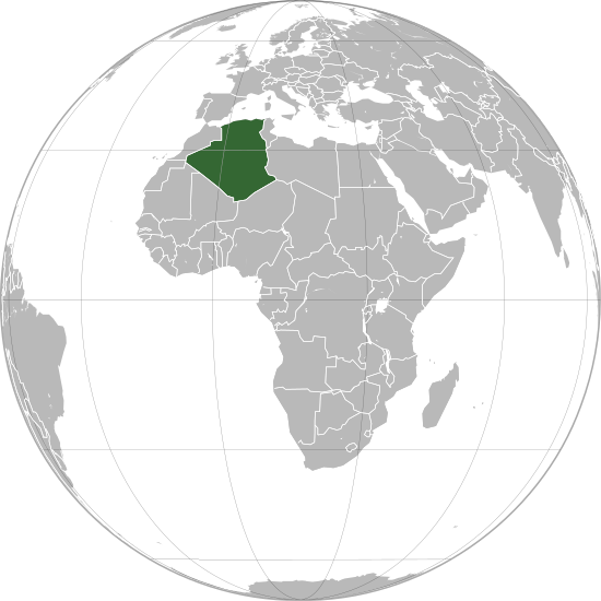
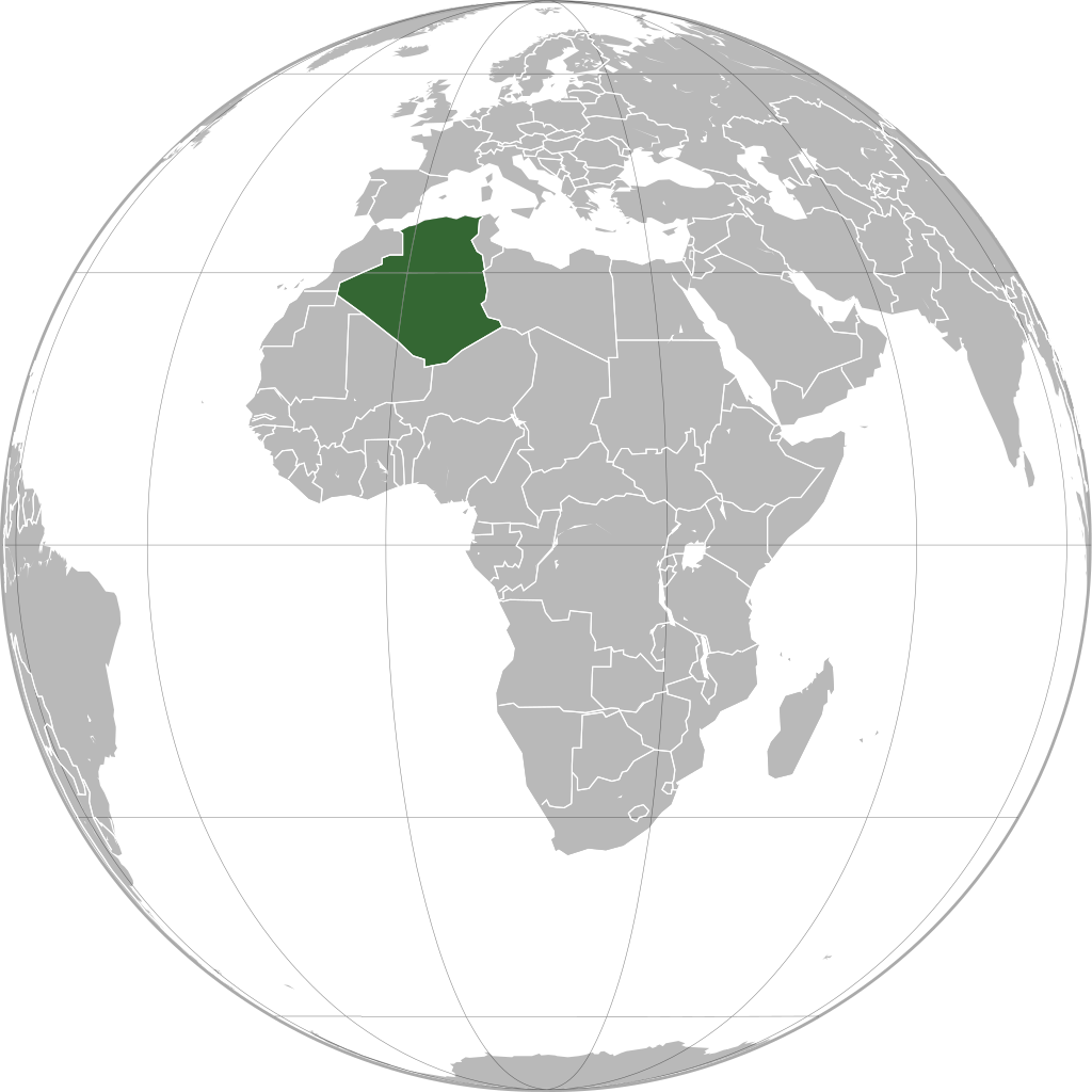
العربية: الخريطة الهجائية للجزائر. English: Orthographic map of Algeria.
Español: Mapa ortográfico de Argelia.
Română: Harta ortogonală a Algeriei. |
| Sewnde | Golle am keeriiɗe |
| Binnduɗo | L'Américain |
Jamirooje
| I, the copyright holder of this work, release this work into the public domain. This applies worldwide. In some countries this may not be legally possible; if so: I grant anyone the right to use this work for any purpose, without any conditions, unless such conditions are required by law. |
Aslol fiilde
Dobo e ñalngu/waktu ngam yiyde fiilde ndee no nde yaltirta e oon waktu nih.
.svg&dir=prev)
.svg&offset=20110103131332)
.svg&offset=&limit=20)
.svg&offset=&limit=50)
.svg&offset=&limit=100)
.svg&offset=&limit=250)
.svg&offset=&limit=500)
| Ñalngu/Waktu | Dooɓre | Ɓete | Kuutoro | Yowre | |
|---|---|---|---|---|---|
| gonaaɗo | 17:22, 27 Bowte 2022 | | 550 × 550 (218 KB) | M.Bitton | Reverted to version as of 13:25, 1 March 2021 (UTC): per COM:OVERWRITE + a centered version already exists |
| 14:41, 24 Bowte 2022 |  | 2 048 × 2 048 (1,25 MB) | Takiva | . | |
| 13:25, 1 Mbooy 2021 |  | 550 × 550 (218 KB) | Trần Nguyễn Minh Huy | Reverted to version as of 13:22, 2 April 2013 (UTC) missing South Sudan | |
| 07:31, 28 Colte 2021 |  | 550 × 550 (281 KB) | Trần Nguyễn Minh Huy | fix scheme | |
| 13:22, 2 Seeɗto 2013 |  | 550 × 550 (218 KB) | Chipmunkdavis | Fixing Moldova, Lebanon, Israel, deleting extra layer of borders | |
| 20:47, 3 Colte 2013 |  | 550 × 550 (186 KB) | Chipmunkdavis | Removing solid fill from the borders so the lakes can be seen | |
| 04:31, 7 Seeɗto 2012 |  | 550 × 550 (186 KB) | Chipmunkdavis | Egyptian and Kenyan administrative borders | |
| 16:10, 14 Siilto 2011 |  | 550 × 550 (186 KB) | Chipmunkdavis | Centreing | |
| 11:08, 12 Morso 2011 |  | 550 × 550 (187 KB) | Marquinhos | Added border Sudan-South Sudan. | |
| 13:13, 3 Siilo 2011 |  | 550 × 550 (281 KB) | Martin H. | Reverted to version as of 22:15, 13 January 2010 |
Kuutorgol fiilde
Alaa kelle kuutotooɗe ndee fiilde.
Kuutoragol fiilde kuuɓtidinngol
Wikiiji ɗii-ɗoo goɗɗi ena kuutoroo ndee fiilde:
- Kuutoragol e ace.wikipedia.org
- Kuutoragol e af.wikipedia.org
- Kuutoragol e ami.wikipedia.org
- Kuutoragol e ar.wikipedia.org
- Kuutoragol e avk.wikipedia.org
- Kuutoragol e azb.wikipedia.org
- Kuutoragol e az.wiktionary.org
- Kuutoragol e bg.wikipedia.org
- Kuutoragol e bh.wikipedia.org
- Kuutoragol e bi.wikipedia.org
- Kuutoragol e bn.wikipedia.org
- Kuutoragol e bug.wikipedia.org
- Kuutoragol e ca.wikipedia.org
- Kuutoragol e cbk-zam.wikipedia.org
- Kuutoragol e cdo.wikipedia.org
- Kuutoragol e ceb.wikipedia.org
- Kuutoragol e chr.wikipedia.org
- Kuutoragol e cs.wikipedia.org
- Kuutoragol e dag.wikipedia.org
- Kuutoragol e da.wikipedia.org
- Kuutoragol e da.wiktionary.org
- Kuutoragol e en.wikipedia.org
- Kuutoragol e en.wikinews.org
- Kuutoragol e en.wiktionary.org
- Kuutoragol e es.wikipedia.org
- Kuutoragol e fr.wikipedia.org
- Kuutoragol e gcr.wikipedia.org
- Kuutoragol e gu.wikipedia.org
- Kuutoragol e gv.wikipedia.org
- Kuutoragol e hak.wikipedia.org
- Kuutoragol e hi.wikipedia.org
- Kuutoragol e hr.wikipedia.org
- Kuutoragol e hy.wikipedia.org
- Kuutoragol e id.wikipedia.org
- Kuutoragol e ie.wikipedia.org
Yiy jokkol kuutoragol kuuɓtidingol ngoo hello.
.svg)
.svg)