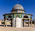
File:Jerusalem-2013(2)-Temple Mount-Dome of the Chain (south exposure).jpg

Ɓetol ngol jiytol: 676 × 600 piksel. weerngooji: goɗɗi 271 × 240 piksel | 541 × 480 piksel | 866 × 768 piksel | 1 154 × 1 024 piksel | 2 308 × 2 048 piksel | 6 500 × 5 767 piksel.
Fiilde asliire (6 500 × 5 767 piksele, ɓetol fiilde: 21,64 MB, mbaydi MIME: image/jpeg)
Aslol fiilde
Dobo e ñalngu/waktu ngam yiyde fiilde ndee no nde yaltirta e oon waktu nih.
| Ñalngu/Waktu | Dooɓre | Ɓete | Kuutoro | Yowre | |
|---|---|---|---|---|---|
| gonaaɗo | 19:31, 15 Bowte 2013 |  | 6 500 × 5 767 (21,64 MB) | Godot13 | Spots removed, sky smoothed, CA removed. |
| 00:37, 10 Bowte 2013 |  | 6 500 × 5 767 (23,11 MB) | Godot13 | Very slight lightening (corners) | |
| 03:40, 9 Bowte 2013 |  | 6 500 × 5 767 (18,11 MB) | Godot13 | NR in sky/smoothing | |
| 23:34, 8 Bowte 2013 |  | 6 500 × 5 767 (22,76 MB) | Godot13 | User created page with UploadWizard |
Kuutorgol fiilde
Ngoo hello ena huutoroo ndee fiilde:
Kuutoragol fiilde kuuɓtidinngol
Wikiiji ɗii-ɗoo goɗɗi ena kuutoroo ndee fiilde:
- Kuutoragol e ar.wikipedia.org
- بوابة:فلسطين
- بوابة:الإسلام/صورة مختارة
- بوابة:فلسطين/صورة مختارة/أرشيف
- ويكيبيديا:ترشيحات الصور المختارة/قبة السلسلة
- قبة السلسلة
- بوابة:فلسطين/صورة مختارة/28
- ويكيبيديا:صور مختارة/أماكن/عمارة
- بوابة:عمارة/صورة مختارة/24
- بوابة:عمارة/صور مساجد
- بوابة:عمارة/صورة مختارة
- ويكيبيديا:صورة اليوم المختارة/فبراير 2015
- قالب:صورة اليوم المختارة/2015-02-28
- ويكيبيديا:صورة اليوم المختارة/أبريل 2016
- قالب:صورة اليوم المختارة/2016-04-07
- بوابة:الإسلام/صورة مختارة/54
- ويكيبيديا:صورة اليوم المختارة/يونيو 2017
- قالب:صورة اليوم المختارة/2017-06-18
- ويكيبيديا:صورة اليوم المختارة/مارس 2018
- قالب:صورة اليوم المختارة/2018-03-05
- ويكيبيديا:صورة اليوم المختارة/مايو 2019
- قالب:صورة اليوم المختارة/2019-05-27
- قبة (عمارة إسلامية)
- ويكيبيديا:صورة اليوم المختارة/أبريل 2021
- قالب:صورة اليوم المختارة/2021-04-05
- ويكيبيديا:صورة اليوم المختارة/مايو 2024
- قالب:صورة اليوم المختارة/2024-05-29
- Kuutoragol e be-tarask.wikipedia.org
- Kuutoragol e be.wikipedia.org
- Kuutoragol e bn.wikipedia.org
- Kuutoragol e ce.wikipedia.org
- Кеп:Таханлера сурт/2014-07
- Кеп:Таханлера сурт/2014-08
- Кеп:Таханлера сурт/2014-10
- Кеп:Таханлера сурт/2014-12
- Кеп:Таханлера сурт/2015-01
- Кеп:Таханлера сурт/2015-03
- Кеп:Таханлера сурт/2015-05
- Кеп:Таханлера сурт/2015-07
- Кеп:Таханлера сурт/2015-08
- Кеп:Таханлера сурт/2015-10
- Кеп:Таханлера сурт/2015-12
- Кеп:Таханлера сурт/2016-01
- Кеп:Таханлера сурт/2016-03
- Кеп:Таханлера сурт/2016-05
- Кеп:Таханлера сурт/2016-07
- Кеп:Таханлера сурт/2016-08
- Кеп:Таханлера сурт/2016-10
- Кеп:Таханлера сурт/2016-12
- Кеп:Таханлера сурт/2017-01
- Кеп:Таханлера сурт/2017-03
Yiy jokkol kuutoragol kuuɓtidingol ngoo hello.


